Satellite Map Live Earth View
Experience real-time satellite imagery and accurate navigation with Satellite Map Live Earth View. now for immersive earth exploration and live GPS features.
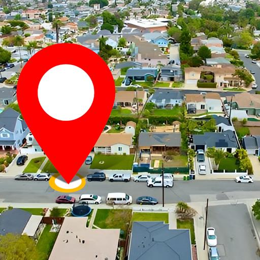
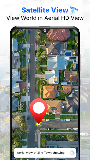
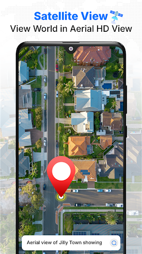
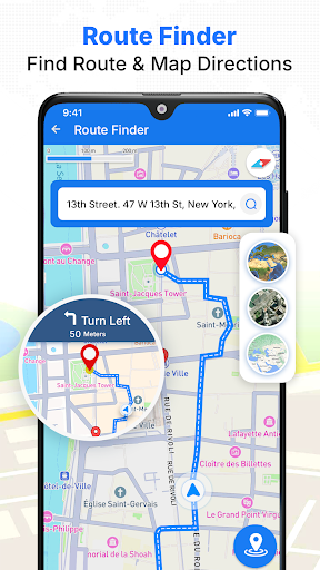
Screenshots
Download Satellite Map Live Earth View
You are going to be redirected to the official website to finish the download when you click the button below.
About Satellite Map Live Earth View
Satellite Map Live Earth View is a versatile mobile app designed for travel and navigation enthusiasts. It offers real-time satellite imagery, detailed Earth views, and dynamic map features that enhance the app experience for users exploring the world. As an Android app, it provides reliable and easy-to-use location-based solutions that make travel planning and outdoor navigation more efficient and informative.
Overview
Core Features
- High-resolution live earth view with real-time satellite imagery, providing accurate and up-to-date maps.
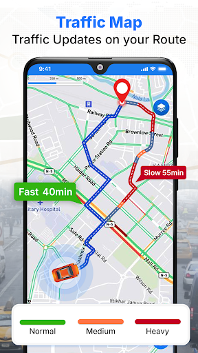
- Seamless navigation features that include real-time traffic updates and turn-by-turn directions for easy travel planning.
- Offline mode support allows users to access maps and satellite images without internet connection, enhancing reliability.
- Integrated location search with voice commands, making it simple to find places quickly using app features.
- User-friendly interface designed to deliver an intuitive app experience on Android devices and other mobile platforms.
- Night mode and customization options to personalize your navigation and map viewing preferences.
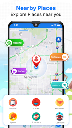
- Detailed points of interest (POIs) and landmarks, assisting travelers in exploring new areas confidently.
Who This App Is For
This mobile app is ideal for travelers, outdoor enthusiasts, and urban explorers who rely on accurate maps and real-time data. Its user-friendly app experience makes navigation straightforward for all ages and skill levels.
Whether you're planning road trips, navigating unfamiliar cities, or simply exploring new places, this app-based solution offers reliable satellite earth view and live traffic info to enhance your travel experiences.
Why Choose This App
This Android app stands out with its combination of detailed satellite imagery and dynamic navigation tools, providing a comprehensive app experience. Its offline feature ensures continuous access to maps even without an internet connection.
With innovative app features and a focus on user trustworthiness, Satellite Map Live Earth View delivers an efficient and dependable app-based solution for all your travel and navigation needs.
Features
Explore the World with High-Resolution Satellite Imagery and Live Updates
Effortless Navigation with Precise GPS Guidance and Route Planning
Immersive 3D Satellite Views for Realistic Earth Exploration
Interactive Map Features with Zoom and Custom Layers for Detailed Viewing
Real-Time Location Tracking and Traffic Alerts for Smooth Travel
Comprehensive Street-Level Satellite Views for Close-Up Urban and Rural Exploration
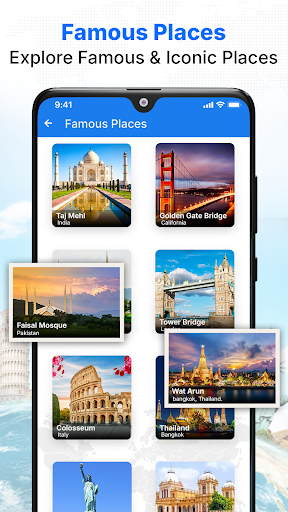
Virtual Travel Experience with Landmark Tours and Stellar Map Features
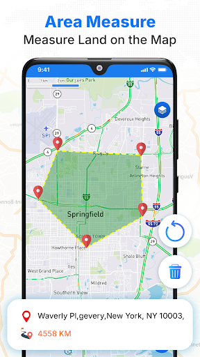
Enhanced User Engagement with Speed Monitoring and Area Measurement Tools
Pros
- +High-resolution live Earth imageryProvides detailed and real-time satellite views of any location worldwide, enhancing user experience.
- +Extensive global coverageAllows users to view virtually any place on Earth with comprehensive satellite data.
- +User-friendly interfaceEasy navigation and intuitive controls make exploring live Earth views accessible to all users.
- +Free access with optional premium featuresBasic features are available at no cost, with upgrades available for additional tools and views.
- +Real-time updatesDisplays current satellite images, enabling timely observation of events and environmental changes.
Cons
- -Limited offline functionalityMost features require internet connection; offline mode support is minimal and could improve.medium
- -Occasional lag or slow loading timesHigh-resolution images may cause delays, especially on slower networks; future optimization is planned.medium
- -Battery consumption can be high during extended useContinuous live viewing drains device battery quickly; users are advised to monitor usage.low
- -Limited historical satellite imagery accessWhile current views are detailed, accessing past images requires upgrade; official updates may expand this.low
- -Geographical coverage gaps in remote regionsSome very remote locations may have less detailed imagery, but improvements are expected with ongoing satellite updates.low