
LandGlide: Land & Parcel Data
Discover land ownership and property boundaries with LandGlide, the leading GPS property finder app. now for quick, reliable land data access.
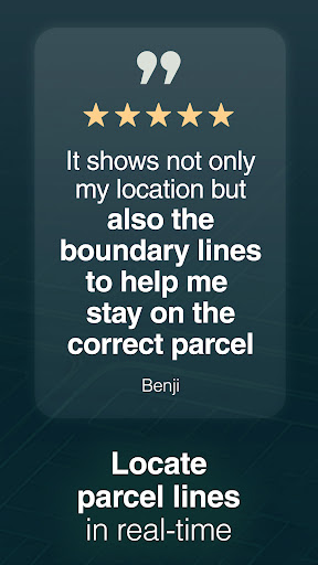
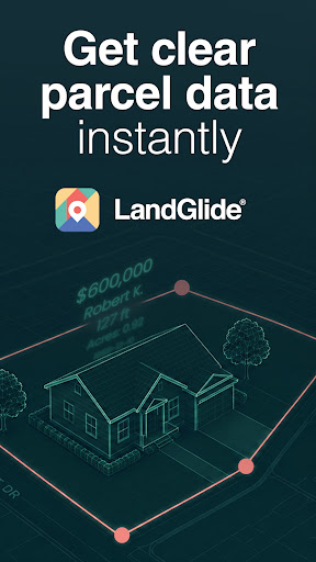
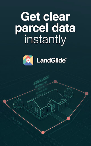
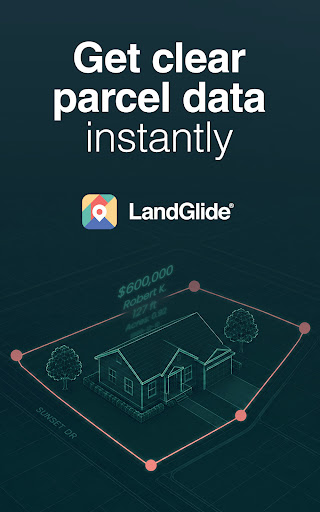
Screenshots


Download LandGlide: Land & Parcel Data
You are going to be redirected to the official website to finish the download when you click the button below.
About LandGlide: Land & Parcel Data
LandGlide: GPS Property Finder is a reliable mobile app designed for property enthusiasts, real estate agents, and landowners. This Android app offers detailed parcel boundary maps, property information, and location data, providing a smooth and informative app experience. Its user-friendly interface makes it easy to access accurate property details directly from your device, making it a valuable app-based solution for land and property research.
Overview
Core Features
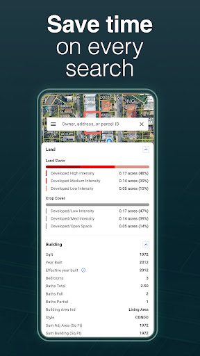
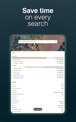
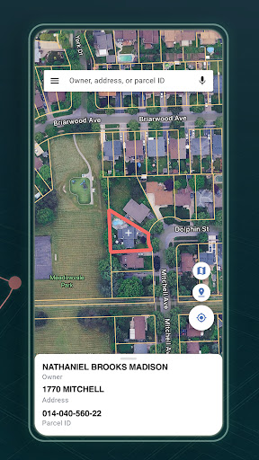
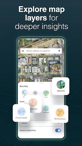
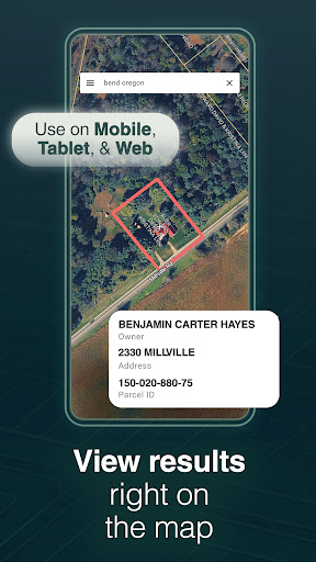
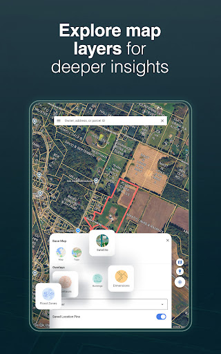
- Comprehensive map layers including parcel boundaries, property data, and aerial imagery for detailed property insights.
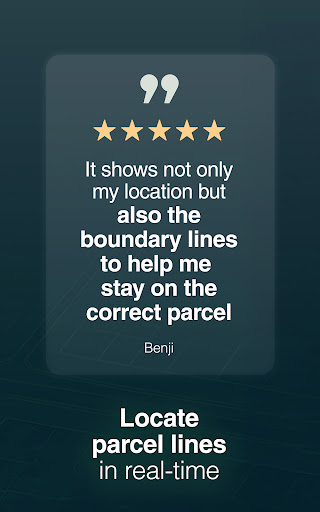
- Real-time GPS tracking and pinpointing that assist users in navigating and locating properties with accuracy.
- Offline mode allowing access to saved property maps and data even without internet connectivity, enhancing usability in remote areas.
- Advanced search filters based on property type, size, or price to quickly find relevant listings or land parcels.
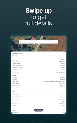
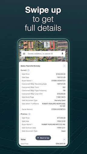
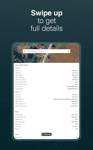
- Detailed property reports and data export options that support app features like data analysis and record keeping.
- Integration with GPS technology providing precise location-based information for land and property searches.
- User-friendly interface designed to deliver a smooth app experience, ideal for both newcomers and experienced land investors.
Who This App Is For
This mobile app is ideal for real estate professionals, land investors, farmers, and property enthusiasts who need accurate location data and property insights. It suits users who prefer an easy-to-use Android app for property hunting or land management.
Whether you're involved in land development, surveying, or simply exploring property options, this app-based solution helps streamline your workflow and enhances your app experience in the field or at the office.
Why Choose This App
This Android app offers a reliable and precise app experience with powerful app features tailored for land and property searches. Its intuitive design and offline capabilities make it stand out among similar solutions.
Choosing this app means gaining an efficient, trustworthy, and feature-rich launcher app for property exploration, helping users make smarter decisions based on comprehensive data and real-time information.
Features
Level 1: Easy-to-Use GPS Property Finder Application
Level 2: Comprehensive Land Data and Precise Location Tracking
Level 3:
- Quickly locate property boundaries with GPS navigation
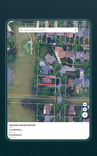
- Access detailed ownership and land information
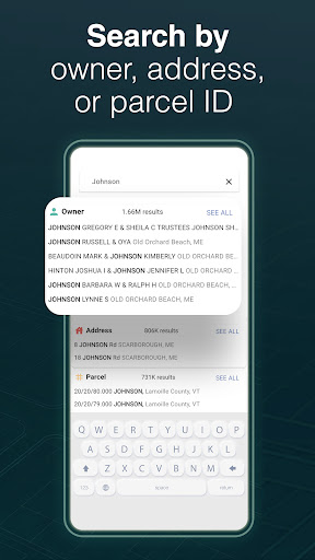
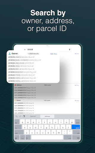
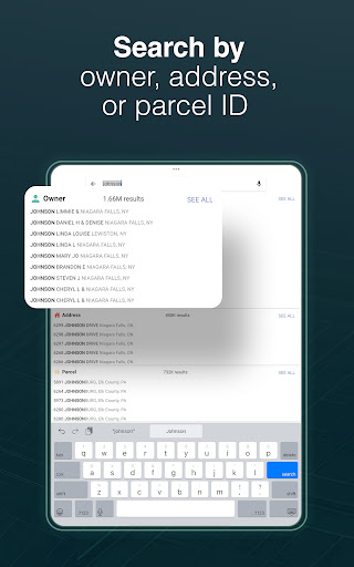
- Search properties by owner, address, or parcel number
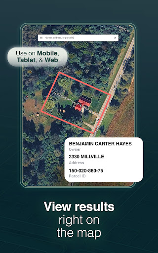
- View parcel details including acreage and building info
Level 4:
- Save and organize favorite properties for quick access
- Export land data to share or keep for reference
Pros
- +Accurate GPS DataLandGlide provides highly precise property boundary details, useful for land transactions.
- +Extensive Property DatabaseAccess to detailed property records across the U.S. enhances research and planning.
- +User-Friendly InterfaceIntuitive navigation makes it accessible for both professionals and casual users.
- +Offline Map AccessAllows users to view property maps without internet, ideal for remote areas.
- +Detailed Property InformationIncludes parcel size, owner info, and lot dimensions to aid decision-making.
Cons
- -Limited Data in Some AreasProperty details may be less comprehensive in rural or less mapped regions, affecting accuracy.medium
- -Occasional GPS DriftGPS signals might sometimes slightly shift boundaries, especially in dense urban environments. Using known landmarks can help verify accuracy.medium
- -Premium Subscription Required for Full AccessFull property data sets are behind paywalls, which may be a barrier for casual users. Improved free features are expected in future updates.low
- -Battery Drain on Mobile DevicesHeavy GPS usage can impact device battery life; using power-saving modes can mitigate this issue.low
- -Learning Curve for New UsersSome users may need time to become familiar with all features; official tutorials are suggested for smoother onboarding.low
FAQ
How do I log in to LandGlide: GPS Property Finder?
To access all the app features, you'll need to create an account or log in. The process is simple and quick through the app's main menu.
Once logged in, you'll enjoy a personalized app experience, making property searches more efficient and tailored to your needs. This enhances trustworthiness and reliability in the app based solution.
Is LandGlide available for both Android and iOS devices?
Yes, LandGlide is available for both Android and iOS devices. You can find the Android app on the Google Play Store and the iOS version on the Apple App Store, ensuring broad accessibility.
This cross-platform availability allows users to enjoy a consistent app experience regardless of their device, making it a versatile mobile app for property searches and land management.
Are the app features suitable for professional land surveyors and homeowners?
Absolutely. LandGlide offers a wide range of app features that cater to both professionals and homeowners. Accurate parcel boundary data and detailed property information are key parts of this app based solution.
This makes the app experience valuable whether you're planning land development, checking property lines, or just curious about land ownership details.
Does using LandGlide raise any safety or privacy concerns?
LandGlide prioritizes user safety and data privacy. The app uses official land records and well-established data sources, providing reliable and lawful information for your land-related needs.
This emphasis on accurate data handling builds trust and credibility, making it a trustworthy app for property research and land management tasks.
Can I use LandGlide without an internet connection?
While the app features function best with an active internet connection, LandGlide does support offline access for certain features like saved parcels. This allows for a smoother app experience even in areas with limited connectivity.
This makes the app based solution more flexible, especially for fieldwork or remote land inspections, providing real-time data when online and useful offline capabilities.